
AlaskaX: 3D GIS
4.3 stars
6 ratings
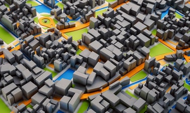
Take your maps into the third dimension: Learn GIS concepts and tools to visualize, analyze, and interpret spatial data in 3D. Reveal patterns that can lead to better decision making.
4 weeks
3–5 hours per week
Self-paced
Progress at your own speed
Free
Optional upgrade available
There is one session available:
After a course session ends, it will be archivedOpens in a new tab.
Starts Apr 18
Ends Jul 31
3D GIS
At a glance
- Institution: AlaskaX
- Subject: Engineering
- Level: Intermediate
- Prerequisites:
GIS1x: Geographic Information System (GIS) Foundations is highly recommended and precedes this course in the edX GIS Professional Certificate.
Windows OS is required to run ArcGIS Pro software.
- Associated programs:
- Professional Certificate in Geographic Information Systems (GIS) Essentials
- Language: English
- Video Transcripts: English, Español
- Associated skills:Geographic Information Systems, Visualization, Cartographic Relief Depiction (Cartography), ArcGIS (GIS Software), Geology, Decision Making, 3D Modeling, Mapping, GIS Applications, Spatial Data Infrastructures, Spatial Analysis, Workflow Management, Land Management, Problem Solving
This course is part of Geographic Information Systems (GIS) Essentials Professional Certificate Program
Learn moreExpert instruction
3 skill-building courses
Self-paced
Progress at your own speed
3 months
3 - 5 hours per week
Interested in this course for your business or team?
Train your employees in the most in-demand topics, with edX For Business.